
Earthen Embankment Integrity Program
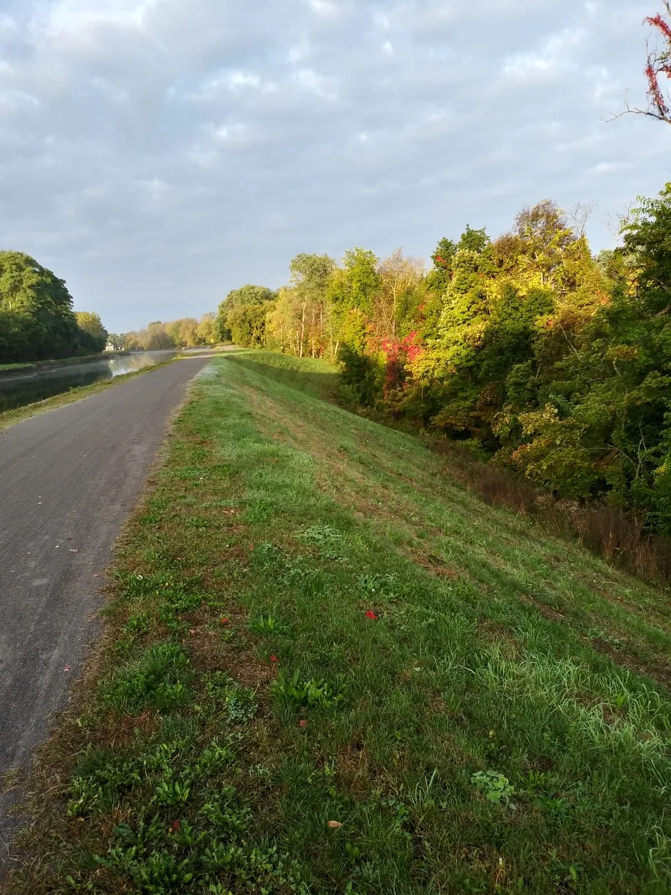
Earthen Embankment, Town of Gaines, NY | Example of a cleared and well-maintained earthen embankment slope east of Eagle Harbor. In this case, we can see the Empire State Trail on the tow path and a slope that is conducive to inspections and maintenance. Mowed grass provides a root structure that prevents erosion during periods of heavy rain.
The Canal system reaches 524 miles across the state. Of those, about 125 miles run through earthen embankments. To maintain and preserve these embankments and the experiences of all who use our system, we have developed an Earthen Embankment Integrity Program (EEIP).
Below, see the progress we’ve made on our program since Oct. 2019, and review our anticipated upcoming schedule. It complies with NYS Department of Environmental Conservation regulatory timeframe requirements and is subject to change. We will update it as the environmental review process progresses. Until then, no trees will be removed unless emergency measures are necessary.
Issue SEQR determination: Oct. 30, 2019
Draft scoping document: June 3, 2020
Public review and comment: June to July 2020
Final Scoping document: Feb. 3, 2021
Draft GEIS and Guidebook: June 23, 2021
Hold public hearings: July 14, 2021
Public review and comment: June 23, 2021 to Oct. 15, 2021
Final GEIS and Guidebook: November 30, 2022
Redlined version: Final GEIS and Guidebook
Public Comments and Response to Comments: November 30, 2022
Example Notice of Completion Letter: November 30, 2022
Publish Findings Statement: December 14, 2022
Embankments along the Erie Canal
As the Erie Canal was originally constructed, and then expanded over time, some sections required laborers to dig into the ground or blast away stone to create the canal channel. In other locations, the canal channel is elevated above the surrounding ground using “earthen embankments” to hold the canal water. These embankments vary in height and length depending on the landscape.
Interactive map
The interactive map on this page was built to provide Canalside residents with a tool to see where the earthen embankments are generally located along the Canal.
In some locations, there are earthen embankments on both sides of the Canal. In others, they are on just one side. The legend (which can be expanded by clicking the double arrow in the upper left corner of the map) identifies which banks of the Canal are earthen embankments.
Instructions
Note: This data is not meant to be survey-level accurate and is only a general visualization of NYS Canal embankment locations.
This map works best on Google Chrome. You can use the plus (+) and minus (-) buttons to zoom to navigate, or use the search bar in the top right to find a specific address. Select your base map by clicking the window icon below the minus button.
To toggle different layers of Canal embankments, feeder routes and the full NYS Canal system map, view the map here.
Need help? Email canalcommunications@canals.ny.gov
East and West Region Embankments
This image maps out all earthen embankments across the 524-mile system.
Western Region Embankments
This image maps out all earthen embankments in the Western Region.
Eastern Region Embankments
This image maps out all earthen embankments in the Eastern Region.
Where are the seeps?
These maps shows areas where seeps or leaks in the Canal have been identified and are being monitored. There are more than 200 known seeps on earthen embankments, most of which have been identified in the last four years as the Canal Corporation developed a more robust inspection program. We inspect earthen dams on foot through “bank walk inspections” as well as using advanced technologies like drones and thermal imaging.
These seeps will continue to be monitored and the database will be updated as new seeps are discovered or as conditions change. We will continue to address and repair seeps based on their condition rating and risk.
This image maps out all seeps that have been identified across the 524-mile system.